GEODNET live on peaqOS: On-Demand, Centimeter-Precise Positioning for Every Robot
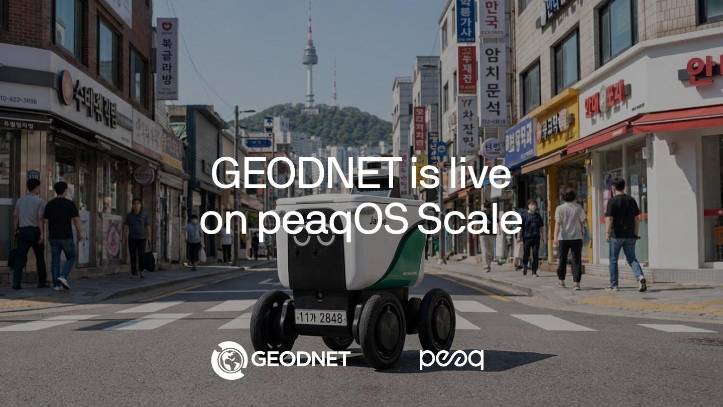


GEODNET’s decentralized, centimeter-precise positioning is now live on robotic.sh — any robot running peaqOS can tap it on demand, complementing other navigation services like NAVER with a high-precision option for more demanding scenarios. Implemented with Tether’s Wallet Development Kit, payment settled on Solana.
A delivery drone is lining up for the dropoff. The package needs to land on a doorstep — not in the flowerbed two meters over. But the drone’s GPS is only sure of its position to within a few meters. At that range, the doorstep and the flowerbed look like the same place.
The drone hesitates.
In the old world, that drone either trusts a position it can’t fully trust and risks the drop or aborts and flies the package all the way back to the depot.
In the new world, it asks for a better fix, gets centimeter-precise positioning in seconds, and sets the package down exactly where it belongs.
That new world is here.
GEODNET Brings High-Precision Positioning to peaqOS Scale
GEODNET is bringing decentralized, centimeter-precise positioning to robots and machines running peaqOS, as the latest service to go live on peaqOS Scale. Starting now, GEODNET’s positioning is available through robotic.sh — so any robot or machine running peaqOS can pull a centimeter-accurate fix on demand, the moment ordinary GPS isn’t good enough.
GEODNET runs the largest decentralized positioning network of its kind: more than 22,000 satellite reference stations and counting, across 160 countries — which makes it the largest reference network on Earth. Centimeter-precise positioning for machines, available now. Not a roadmap item. Not a pilot.
Until today, most robots in the world navigated with the same satellite positioning that’s in your phone — good enough to find a street, not good enough to find a doorstep. Now any machine running peaqOS can reach into GEODNET the moment it needs a centimeter-accurate fix, on any chain, and pay for it autonomously.
— Till Wendler, peaq’s co-founder
GEODNET was built so high-precision positioning isn’t locked behind expensive, centralized infrastructure. Robots, drones, and autonomous vehicles are about to become some of the biggest consumers of precise location on earth.
— Mike Horton, Project Creator of GEODNET
Showcase: Robotic Delivery with NAVER Maps and GEODNET
In a public demo, we simulate the workflow of a delivery drone leveraging NAVER Maps and GEODNET to handle a shipping task undertaken by a hard-working delivery robot in Seoul. Each service comes in when its respective precision level is needed; the settlement is handled in USDT on Solana via Tether’s Wallet Development Kit.
→ Step 1: Route order. With peaqOS, the robot links up with NAVER to get the optimal route to its destination based on its current location.
→ Step 2: Static map order. Approaching its destination, the robot pulls the local context data for its target area from NAVER to optimize the final delivery.
→ Step 3: GEODNET RTK validation order. The robot pulls high-precision positioning data from GEODNET, shifting to centimeter precision, to make sure the recipient knows exactly where to pick up the package — and no flowerbeds get ridden over in the process.
The public demo showcases how robots can use multiple services on robotic.sh to solve complex challenges. Every new service added compounds the peaqOS Scale’s overall value, unlocking more and more opportunities for builders and robotics companies.
Why This Matters: The Positioning Problem Machines Have Always Had
Most robots navigate with the same satellite positioning that’s in your phone. It’s good enough to tell you which street you’re on. It is not good enough to land a drone on a doorstep, steer a tractor between two rows of crops, or dock a delivery robot at the right bay.
Standard GPS drifts by meters. For a machine doing real work in the real world, meters are the difference between a job done and a job failed — or a collision.
The usual answers aren’t good enough. You bolt expensive surveying hardware onto every machine and maintain it forever, or you accept the drift and design around worse performance. Neither scales to fleets of machines operating autonomously.
Centimeter-precise positioning changes the equation. GEODNET’s network delivers real-time kinematic (RTK) correction that is around 100x more accurate than standard GPS, with each reference station serving every machine within 20–40 km. When a machine needs to know exactly where it is, peaqOS routes that request to GEODNET through robotic.sh, and the precise fix returns directly to the machine.
No surveying rig on every robot. No accepting the drift. No dependency on a single centralized provider.
peaq Orchestrates the Value Exchange
Behind the scenes, peaq coordinates the full Machine Economy layer around every positioning request:
- Machine identity verification
- Data signing with peaqID
- Trusted execution coordination
- Provider reputation
- Payment settlement
- Verifiable receipts
Machines stay autonomous. Their sense of where they are simply sharpens on demand.
Real-World Scenarios
Scenario 1 — A Last-Mile Delivery Robot Finds the Exact Doorstep
A delivery robot threads through a dense neighborhood. Standard GPS gets it to the right block, but the last few meters are where deliveries succeed or fail: the correct gate, the correct doorstep, not the neighbor’s driveway.
As it nears the address, the robot requests a centimeter-accurate fix through robotic.sh. GEODNET returns the precise position in seconds. The robot places the package exactly where it belongs, confirms the drop, and moves on to the next stop.
Precision only when it’s needed — not expensive hardware idling on every unit.
Scenario 2 — An Autonomous Tractor Holds the Line Between the Rows
An autonomous tractor works a field at dawn. Planting, spraying, and harvesting all demand it hold a line within centimeters; drift of even half a meter means crushed crops, wasted seed, and overlapping passes.
The tractor pulls centimeter-precise correction from GEODNET via robotic.sh and steers down the row with no overlap and no damage. Across a full field, that precision turns into saved seed, saved fuel, and a cleaner harvest — paid for autonomously, only for the hours the machine is actually working.
Available Now on robotic.sh
Centimeter-precise positioning from GEODNET is live on robotic.sh for robots and machines running peaqOS.
Machines can discover the service, request a precise fix, and expand what they can do — dynamically and on demand.
Because autonomous machines shouldn’t be limited to knowing roughly where they are.
They should know exactly.
→ Visit robotic.sh to get started.
FAQ
.png)
